
![]()
Historic Maps and Plans of Inland Navigation
www.canalmaps.net
|
|
Historic Maps and Plans of Inland Navigation |
||
|
www.canalmaps.net |
|||
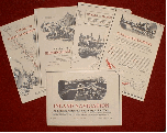
THE ARCHIVE
- is a personal and fairly random collection of over 1,000
original maps and plans of canals and inland river navigations brought together
over the last forty years, with the emphasis on the British Isles.
Dating from 1677 to the present day, there are many examples from the
‘canal age’ 1760-1830 both manuscript and printed.
The range includes small engraved sketch maps of proposed schemes, maps
of the system at different times, and detailed surveys of completed inland waterways.
Expansion of the collection continues, and offers of similar material are
always welcome.
THIS WEBSITE
- aims to make the information about the archive widely available for the benefit of researchers and others interested in the history and development of the waterway network.
Clicking on the 'List'
button in the page heading will bring up an alphabetical listing of some of the
maps in the collection. Only a
small proportion are as yet detailed, but it is the intention that the
bulk of the collection will eventually be included.
Until then, please ask if you have any specific requirements for canal
cartography.
All the text and images are
copyright, and may be downloaded only for private research or to illustrate
student theses etc. Larger
maps have been copied in sections, and the
online images are of low resolution, to keep file sizes small. Better quality
copies may be purchased, and permission for publication or further reproduction
granted by arrangement.
CONTACT US
For all enquiries or
further details regarding the Archive or website please e-mail:
Info@canalmaps.net
BRIEF INTRODUCTION TO THE HISTORY OF WATERWAY CARTOGRAPHY
- Click on blue text
for examples.
The development of
artifical waterways was a significant factor driving improvements in survey and
preparation of accurate maps and plans, and in turn was aided by them.
Any attempt at classification of waterway maps cannot be definitive, but
a number of general families evolved, a selection of which are mentioned here.
Promotion of a river
improvement or canal would impact on many individuals and communities, and
rapidly generated small maps, sometimes very sketchy, to give an overview of the
scheme. These would be issued by
the promoters, by opponents, or by interested
observers.
Such maps are often found as part of a prospectus document, aimed at
persuading potential investors to finance the scheme.
If the project developed, a
more detailed engineering survey was undertaken to define an exact route and the
lands that it would pass through. The
availability of such a plan for public inspection was directed by a few Canal
Acts from the 1760s, and codified from 1792 in Standing Orders which obliged all
canal promoters to deposit a suitable plan prior to introduction of a Bill in
Parliament, so that anyone could check to see if they were affected, and
petition against it if necessary. The
plans are an excellent source, but need interpreting with care as they generally
show what was proposed rather than actually built – but later ones for
improvements or railway conversion are a good source of accurate information on
the existing situation.
Engineers construction
plans have rarely survived, particularly for the earlier period, but useful plans
were sometimes appended to title deeds and associated
land documentation.
Prior to the advent of
large-scale Ordnance Survey coverage, landowners needed plans to manage their
property, and these were provided by ad hoc surveys of particular estates.
Quality varied according to the skill of the private surveyor employed
and the depth of the client’s pocket. Canal
companies, and canal-owning railway companies, often commissioned such surveys,
and the manuscript or lithographed plans provide an excellent
detailed picure of the waterway at particular dates.
Much trade was local to a
particular waterway, and companies issued maps of their concerns for the benefit
of traders. Carriers developed longer distance traffic and
their advertising sometimes included maps. The
earliest attempt at a more general coverage was probably about 1765,
but early maps of connected systems produced by
cartographers, whilst giving a valuable overview, often imported errors from
sources, particularly the inclusion
of canals as yet unbuilt.
Pleasure use of waterways during the Victorian period tended to be restricted to limited areas, and a few maps appeared, especially of the Thames, to cater for it. More general use was slower to develop, but interest in canoeing produced some early leisure maps of the system, and many more followed during the later part of the 20th century.
LINKS
|
CARTOGRAPHICS - Out of print Maps & Plans Trading since 1969 in out of print cartography and related literature, we specialise in large scale topographic material of any date including Ordnance Survey, town plans, estate maps, railway, canal, road maps and similar both printed and manuscript. Generally we avoid pretty or decorative items in favour of historically useful detailed surveys, both UK and worldwide. Stock of over 80,000 items. Website www.cartographics.co.uk |
 |
HISTORICAL CANAL MAPS SERIES - This successful series is now established as a standard reference for transport and local historians needing reliable mapping of our inland waterways. Researched and drawn by Richard Dean, they show the fullest extent of Britain's canal and river navigation network including all the mileage lost over the years, together with engineering features. Based largely on original sources, they detail the type and position of the navigations and their branches with as much accuracy as the scale allows, also the routes of authorised and unfinished schemes. The larger scale area sheets also mark basins, locks, bridges, aqueducts, wharves etc as built, together with available information on Acts and dates of opening and disuse. Much of this information has not previously been readily available, and certainly not in such a concise and comprehensive form. Further details at www.cartographics.co.uk/page3.htm |