![]()
Historic Maps and Plans of Inland Navigation
www.canalmaps.net
|
|
Historic Maps and Plans of Inland Navigation |
||
|
www.canalmaps.net |
|||
| Canalmaps ref. | A87 |
| Waterway | Ellesmere Canal |
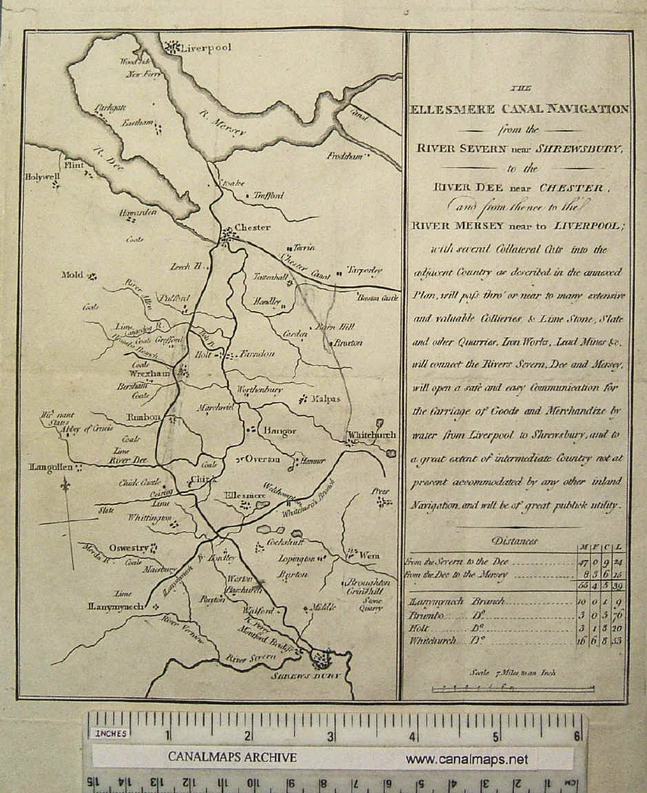
| Title | The Ellesmere Canal Navigation from the River Severn near Shrewsbury, to the River Dee near Chester, and from thence to the River Mersey near Liverpool; |
| Description | Small promotional map with inset text |
| Date | [1793] |
| Names | |
| Scale | 7 miles/inch |
| Medium | Engraving on paper with pencil annotation |
| Source | Believed to have been separately issued |
| Notes | Probably prepared early in 1793, showing the scheme prepared by John Duncombe and approved by William Jessop which was then in Parliament, being authorised by the Ellesmere Canal Act of April that year. Of particular interest are the faint traces of roads which have been deleted from the plate, presumably to simplify the map, and the rough contemporary annotation in pencil showing the connection between Whitchurch and the Chester Canal which was provided for in the Act to satisfy the promoters of the rival Eastern Canal after the two factions merged in February. |
.
.