![]()
Historic Maps and Plans of Inland Navigation
www.canalmaps.net
|
|
Historic Maps and Plans of Inland Navigation |
||
|
www.canalmaps.net |
|||
| Canalmaps ref. | A800 |
| Waterway | General |
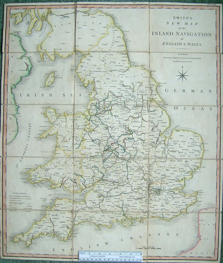
| Title | Smith's New Map of the Inland Navigation of England & Wales. |
| Description | |
| Date | November 30 1801, corrected to January 1808 |
| Names | Engraved by Jones & Smith, Pentonville, and printed for C. Smith, No. 172 (corner of Surrey St) Strand. |
| Scale | Approx 17 miles/inch |
| Size in inches | 21 x 25 |
| Medium/format | Hand coloured engraving, sectioned and mounted on linen folding into contemporary card slipcase with printed label. |
| Source | Ownership signature on map - J. S. Salt |
| Notes | A nicely engraved map, but with some inaccuracies, mainly by marking canals that had not been built such as the Pontcysyllte to Chester section of the Ellesmere, and the main line of the Dorset& Somerset. |
Click on any part of the image for an enlarged view.
Use your browser's back button to return to this page