
![]()
Historic Maps and Plans of Inland Navigation
www.canalmaps.net
|
|
Historic Maps and Plans of Inland Navigation |
||
|
www.canalmaps.net |
|||
| Canalmaps ref. | B367 |
| Waterway | Wakefield and Ferrybridge Canal (Proposed) |
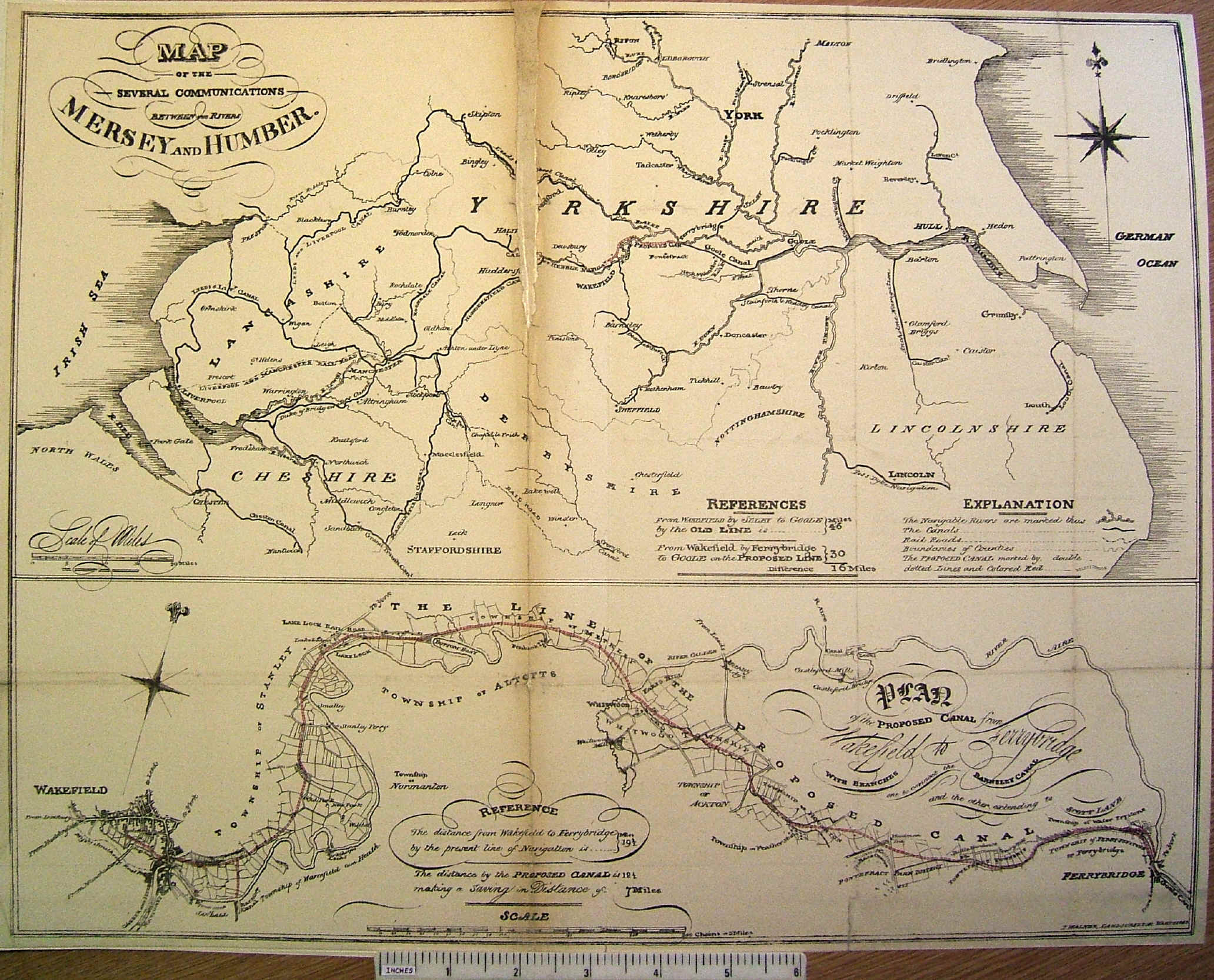
| Title | (1)Map of the several communications between the Rivers Mersey and Humber (2)Map of the proposed Canal from Wakefield to Ferrybridge with branches, one to connect the Barnsley Canal, the other to Scott Lane. |
| Description | Two maps on one sheet as part of a prospectus. |
| Date | 1827 |
| Names | J. Walker, Land Surveyor, Wakefield |
| Scale | (1) 10 miles/inch (2) 0.75 miles/inch |
| Size in inches | 17 x 13 |
| Medium/format | Lithographed on paper folded into letterpress folio. Modern conservation. |
| Source | Prospectus of the Wakefield and Ferrybridge Canal |
| Notes | Proposals for a canal bypassing the Aire & Calder Navigation which was vigorously opposed and did not proceed. It did however prompt the A&CN into major improvements to their own antiquated waterway. |
 |
 |
 |