![]()
Historic Maps and Plans of Inland Navigation
www.canalmaps.net
|
|
Historic Maps and Plans of Inland Navigation |
||
|
www.canalmaps.net |
|||
| Canalmaps ref. | A629 |
| Waterway | General |
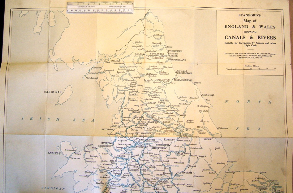
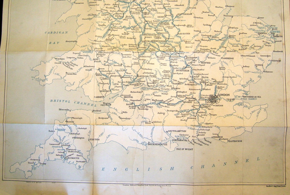
| Title | Stanford's Map of England & Wales showing Canals & Rivers suitable for Navigation by Canoes and other Light Craft. |
| Description | |
| Date | 1934 |
| Names | Edward Stanford Ltd, London. Reference to Table of Distances given in 'Canoeing' by William Bliss |
| Scale | 14 miles/inch |
| Size in inches | 27 x 30 |
| Medium/format | Lithograph cloth backed and folding in hard covers with Stanford label |
| Source | |
| Notes | Early example of a map to meet leisure use of the waterways. Reissued several times in later editions. |