![]()
Historic Maps and Plans of Inland Navigation
www.canalmaps.net
|
|
Historic Maps and Plans of Inland Navigation |
||
|
www.canalmaps.net |
|||
| Canalmaps ref. | A609 |
| Waterway | Thames Navigation |
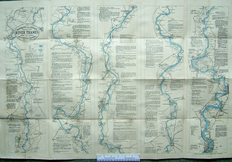
| Title | The Oarsman's and Angler's Map of the River Thames from its source to London Bridge. |
| Description | Strip map in five lengths on one sheet |
| Date | April 4th 1881. New Edition 1897. |
| Names | James Reynolds & Sons, 174 Strand, London |
| Scale | 1 inch/mile |
| Size in inches | 33 x 24 |
| Medium/format | Lithograph with River hand coloured, folded in hard covers with 12 pages of notes. |
| Source | |
| Notes | Early leisure map much reprinted and reissued, later by Stanford. |
Click on any part of the image for an enlarged view.
Use your browser's back button to return to this page