![]()
Historic Maps and Plans of Inland Navigation
www.canalmaps.net
|
|
Historic Maps and Plans of Inland Navigation |
||
|
www.canalmaps.net |
|||
| Canalmaps ref. | A702 |
| Waterway | General |
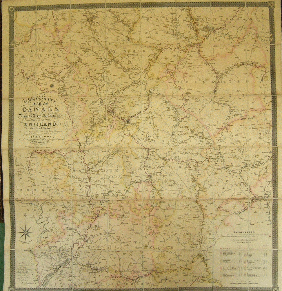
| Title | G. Bradshaw's Map of the Canals, Navigable Rivers, Rail Roads &c in the Midland Counties of England. |
| Description | |
| Date | February 12th 1829 (but neatly amended in ink by publisher to 1830) |
| Names | Levels taken by Twyford & Wilson, Surveyors and Engineers, Manchester. Published by G. Bradshaw, Manchester. Sold by Mr. Jas. Gardner 163 Regent Street London. Dedication to Thomas Telford. Engraved and Printed by W. R. Gardner. |
| Scale | 2 miles/inch |
| Size in inches | 49 x 54 |
| Medium/format | Hand coloured engraving on four sheets, joined, sectioned and cloth mounted to fold. |
| Source | |
| Notes | An early state of this important map which was rapidly amended and reissued over a short period. Click on any part to see an enlargement of that section. |