![]()
Historic Maps and Plans of Inland Navigation
www.canalmaps.net
|
|
Historic Maps and Plans of Inland Navigation |
||
|
www.canalmaps.net |
|||
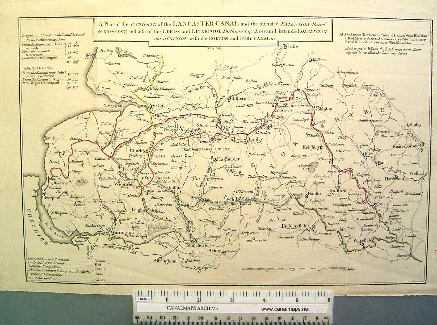
| Canalmaps ref. | B22 |
| Waterway | Leeds and Liverpool Canal |
| Title | A Plan of the South End of the Lancaster Canal and the intended extension thereof to Worsley; and also of the Leeds and Liverpool Parliamentary Line, and intended Deviation and junction with the Bolton and Bury Canal &c. |
| Description | Small map by opposers of the L&L scheme. |
| Date | 1794 |
| Names | Engraved by J. Cary |
| Size in inches | 12 x 7 |
| Scale | 6 miles/inch approx |
| Medium/format | Engraving on paper, hand coloured, folded |
| Source | [From pamphlet 'Answer to the case of the Leeds and Liverpool Canal proprietors on behalf of the petitioners against the Bill'] |
| Notes | The proposed deviation of the uncompleted Leeds & Liverpool Canal to a new alignment through the expanding industrial towns of East Lancashire was designed also to give a connection to Manchester by a link to the Manchester Bolton & Bury Canal at Bolton. This alarmed the Lancaster Canal Company, who had aspirations of extending their partly built canal, through Leigh, to the Bridgewater Canal at Worsley, and they fought the extension Bill in Parliament. A compromise was agreed involving a junction at Heapey, and the L&L deviation Act passed in May 1794. The map gives a good overview of the competing canal proposals in the area. |