![]()
Historic Maps and Plans of Inland Navigation
www.canalmaps.net
|
|
Historic Maps and Plans of Inland Navigation |
||
|
www.canalmaps.net |
|||
| Canalmaps ref. | V2 |
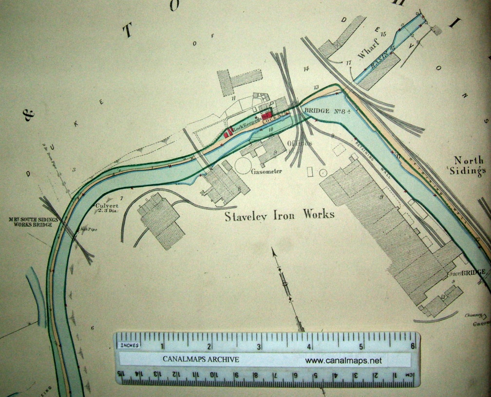
| Waterway | Chesterfield Canal |
| Title | Plans of the Manchester Sheffield and Lincolnshire Railway Canal and Lands - Chesterfield Canal. |
| Description | Detailed survey in sheets of the whole canal from Chesterfield Wharf to the River Trent at West Stockwith, including reservoirs and feeders. |
| Date | 1892 |
| Names | Henry Fowler, Surveyor and lithographer, Manchester. Wm. Pollitt, General Manager |
| Scale | 2 chains (132 feet)/inch |
| Size in inches | Sheet size 42 x 26 |
| Medium/format | 31 hand coloured lithographed sheets, cloth backed, centre folded and bound as an atlas. Modern half leather rebind. |
| Source | MS&L (later Great Central) Railway. |
| Notes | Surveyed and printed for general and estate administration within the Company, a very detailed record of the waterway and property within two chains either side of it. Identifies the vendors of the land originally taken for building the canal. Small extract only illustrated below. |