![]()
Historic Maps and Plans of Inland Navigation
www.canalmaps.net
|
|
Historic Maps and Plans of Inland Navigation |
||
|
www.canalmaps.net |
|||
| Canalmaps ref. | A838 |
| Waterway | General |
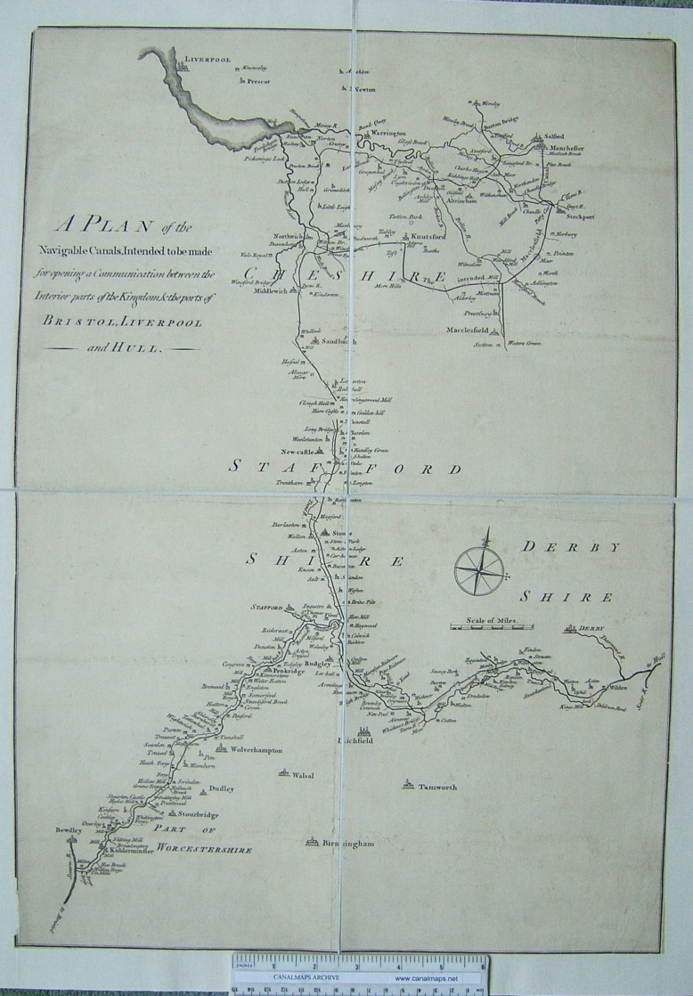
| Title | A Plan of the Navigable Canals, intended to be made for opening a Communication between the Interior parts of the Kingdom, & the ports of Bristol, Liverpool and Hull. |
| Description | Map of the area between Liverpool, Manchester, Bewdley, and Derby |
| Date | c1765 |
| Names | |
| Scale | No indication |
| Size in inches | 16 x 24 |
| Medium/format | Engraving, folded. Cropped to outer edge of frame. Later conserved, sectioned and cloth mounted. |
| Source | |
| Notes | Probably compiled entirely from surveys of proposals. 'The intended Macclesfield Canal' failed in Parliament. The branch of the Bridgewater Canal to Stockport was authorised but not built. |
Click on any part of the image for an enlarged view.
Use your browser's back button to return to this page