![]()
Historic Maps and Plans of Inland Navigation
www.canalmaps.net
|
|
Historic Maps and Plans of Inland Navigation |
||
|
www.canalmaps.net |
|||
| Canalmaps ref. |
A4 |
| Waterway |
Birmingham Canal Navigations |
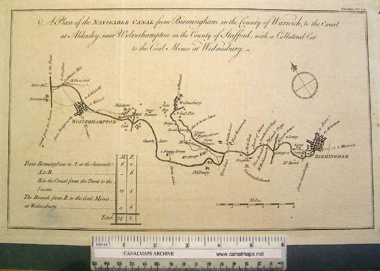
| Title |
A Plan of the Navigable Canal from Birmingham in the County of Warwick, to the Canal at Aldersley, near Wolverhampton in the County of Stafford; with a Collateral Cut to the Coal Mines at Wednesbury. |
| Description |
Small map from a contemporary periodical |
| Date |
1771 |
| Names | |
| Scale |
2 miles/inch approx |
| Size in inches |
11 x 7 |
| Medium/format |
Engraving on paper, folded. |
| Source |
Gentlemans Magazine, October 1771 |
| Notes |
This is perhaps the earliest map to show the Birmingham Canal as building (it was opened in stages 1769-73) incorporating the realignments resulting from abolition of the proposed tunnel at Smethwick. This successful waterway was much altered and improved in later years. |