![]()
Historic Maps and Plans of Inland Navigation
www.canalmaps.net
|
|
Historic Maps and Plans of Inland Navigation |
||
|
www.canalmaps.net |
|||
| Canalmaps ref. | V1 |
| Waterway | Grantham Canal |
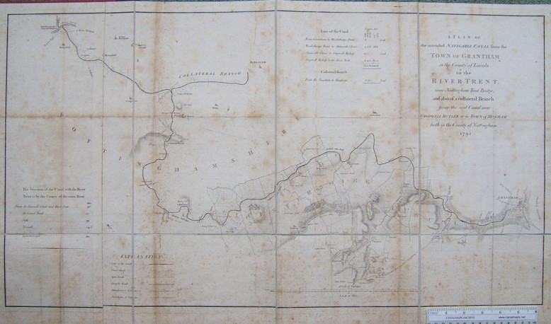
| Title | A Plan of the intended Navigable Canal from the Town of Grantham in the County of Lincoln, to the River Trent, near Nottingham Trent Bridge;and also of a collateral Branch from the said Canal near Cropwell Butler to the Town of Bingham both in the County of Nottingham. |
| Description | Parliamentary plan |
| Date | 1792 |
| Names | |
| Scale | 0.75 miles/inch approx |
| Size in inches | 30 x 17 |
| Medium/format | Engraving, sectioned and cloth mounted |
| Source | Separately issued map. |
| Notes | As originally designed the canal was to join the Trent near Ratcliffe, as shown on an earlier state of this plan. When the decision was taken to extend it to Nottingham the map was altered and a supplementary plate had to be engraved to increase the westerly coverage, so that the present map is comprised of two portions pasted together. The junction line runs through the village of Basingfield. The canal was built largely according to this plan, although the Bingham Branch was not constructed. |
Click on any part of the image for an enlarged view.
Use your browser's back button to return to this page